Common sense isn't.
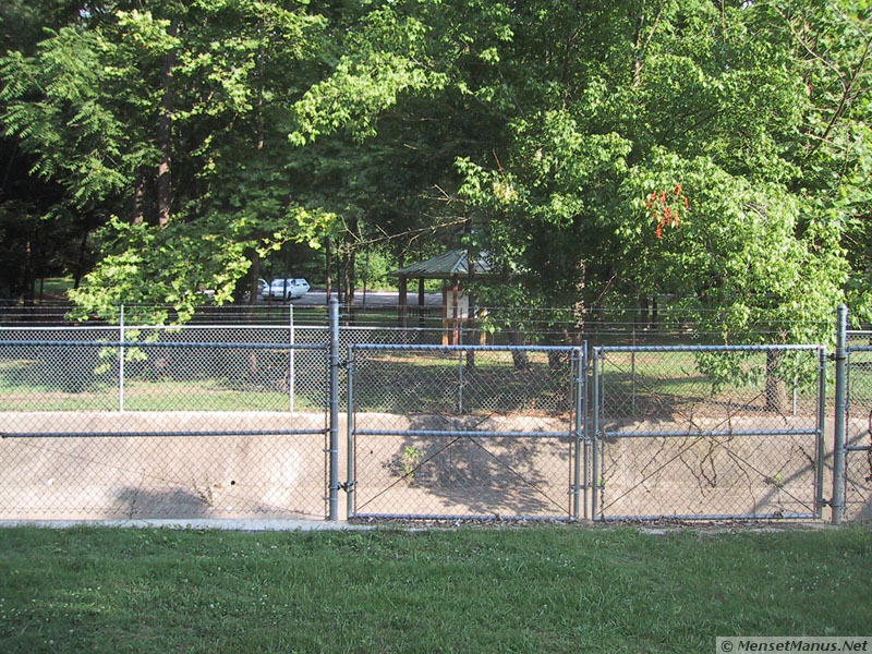
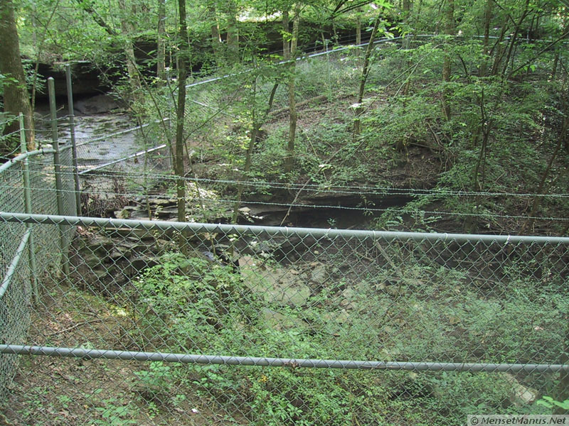
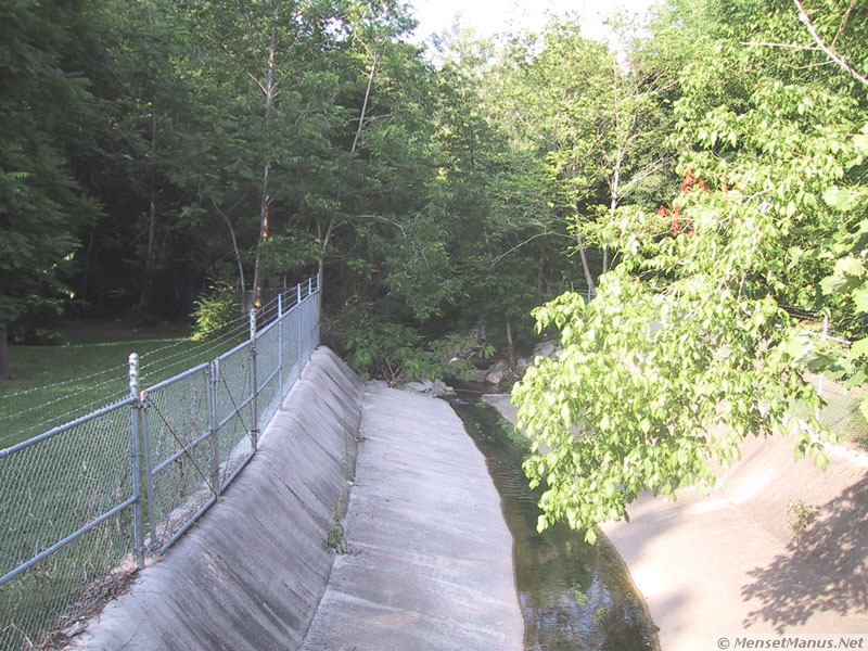
View across drainage canal, which flows to left to the sink hole, towards the park with information sign kiosk.
OpenStreetMap approximate location of parking entrance
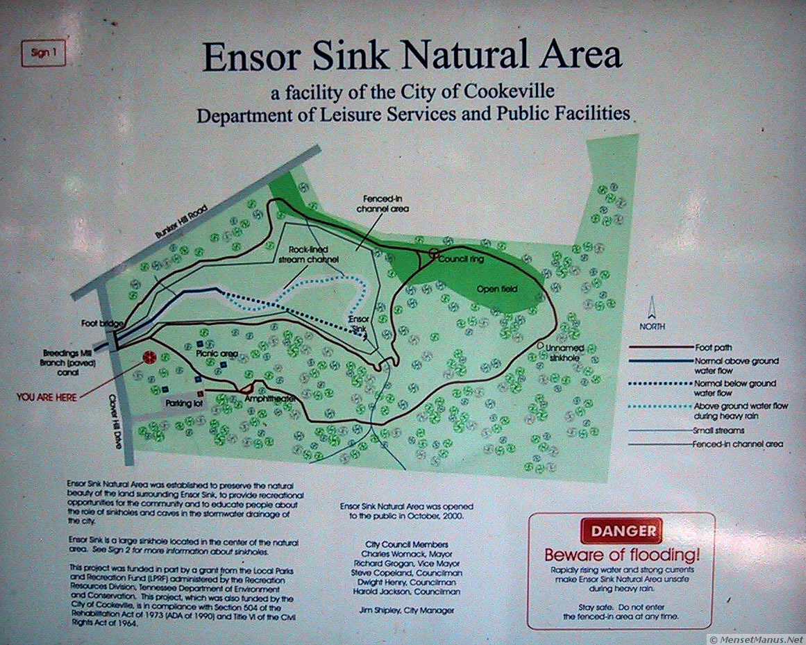
Ensor Creek Natural Area was established to preserve the natural beauty of the land surrounding Ensor Sink, to provide recreational opportunities for the community and to educate people about the role of sinkholes and caves in the stormwater drainage of the city.
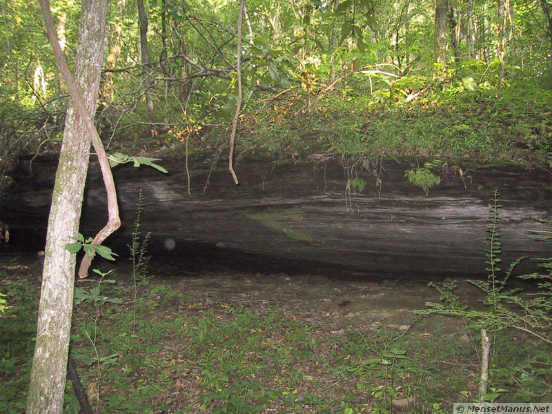
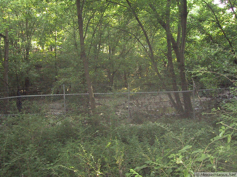
Ensor Sink is a large sinkhole located in the center of the natural area. See Sign 2 for more information about sinkholes.
This project was funded in part by a grant from the Local Parks and Recreation Fund (LPRF) administered by the Recreation Resources Division, Tennessee Department of Environment and Conservation. This project, which was also funded by the City of Cookeville, is in compliance with Section 504 of the Rehabilitation Act of 1973 (ADA of 1990) and Title VI of the Civil Rights Act of 1964.
 Rapidly rising water and strong currents make
Ensor Sink Natural Area unsafe during heavy rain.
Rapidly rising water and strong currents make
Ensor Sink Natural Area unsafe during heavy rain.
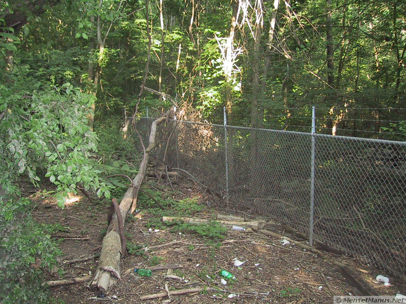
Stay safe. Do not enter the fenced-in area at any time.
Ensor Sink Natural Area was opened to the public in October, 2000.
City Council Members
Charles Womack, Mayor
Richard Grogan, Vice Mayor
Steve Copeland, Councilman
Dwight Henry, Councilman
Harold Jackson, Councilman
Jim Shipley, City Manager
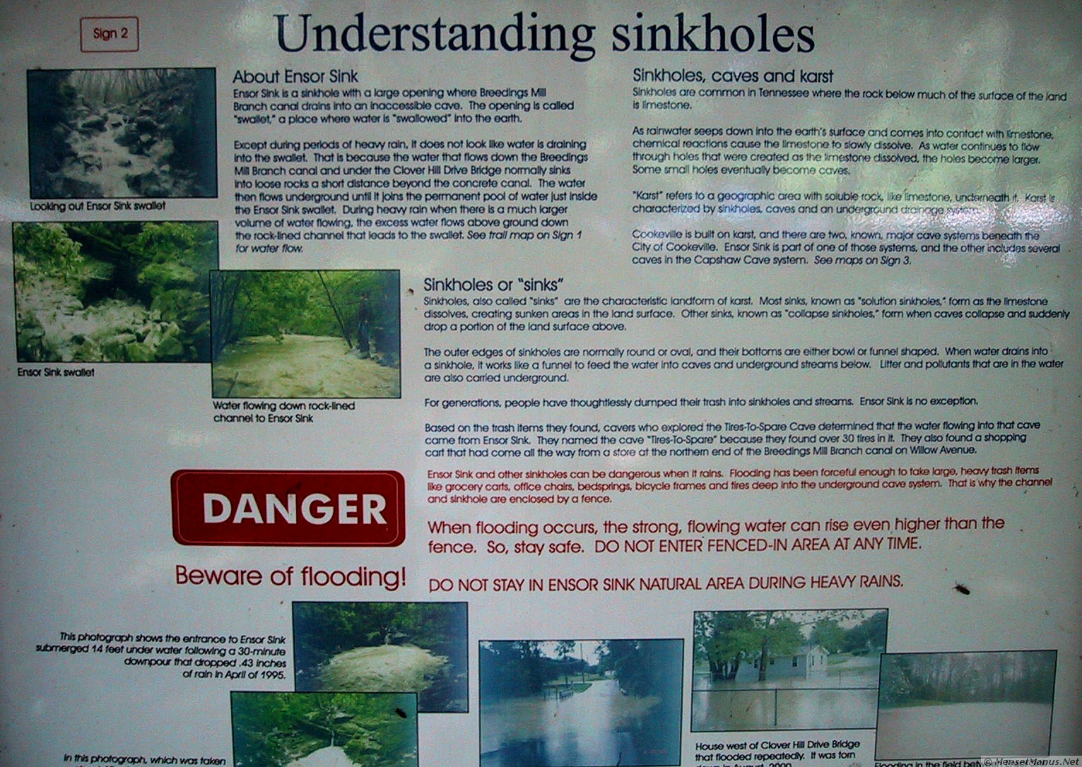 Text from Sign Number 2:
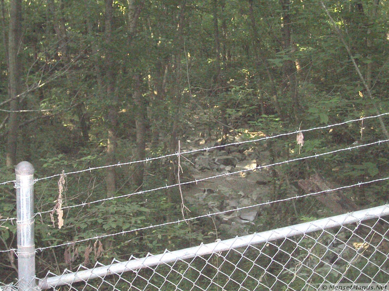
Except during periods of heavy rain, it does not look like water
is draining into the swallet. That is because the water that flows
down the Breedings Mill Branch canal and under the Clover Hill
Drive Bridge normally sinks into loose rocks a short distance
beyond the concrete canal. The water then flows underground until
it joins the permanent pool of water just inside the Ensor Sink
swallet. During heavy rain when there is a much larger volume of
water flowing, the excess water flows above ground down the
rock-lined channel that leads to the swallet. See trail map on
Sign 1 for water flow.
As rainwater seeps down into the earth's surface and comes into contact with limestone, chemical reactions cause the limestone to slowly dissolve. As water continues to flow through holes that were created as the limestone dissolved, the holes become larger. Some small holes eventually become caves.
"Karst" refers to a geographic area with soluble rock, like limestone, underneath it. Karst is characterized by sinkholes, caves and an underground drainage system.
Cookeville is built on karst, and there are two, known, major
cave systems beneath the City of Cookeville. Ensor Sink is part of
one of those systems, and the other includes several caves in the
Capshaw Cave system. See maps on Sign
3.
The outer edges of sinkholes are normally round or oval, and their bottoms are either bowl or funnel shaped. When water drains into a sinkhole, it works like a funnel to feed the water into caves and underground streams below. Litter and pollutants that are in the water are also carried underground.
For generations, people have thoughtlessly dumped their trash into sinkholes and streams. Ensor Sink is no exception.
Based on the trash items they found, cavers who explored the
Tires-To-Spare Cave determined that the water flowing into that
cave came from Ensor Sink. They named the cave "Tires-To-Spare"
because they found over 30 tires in it. They also found a shopping
cart that had come all the way from a store at the northern end of
the Breedings Mill Branch canal on Willow Avenue.
 Text from Sign Number 3:
All of the rain that falls onto the land area shown in blue on these maps flows to the same point. This area shows several small, subwatersheds within Cookeville city limits. The darker blue subwatershed drains into Ensor Sink. See Sign 4 for more information about watersheds and subwatersheds.
Stormwater flows above ground in streams and rivers, and below ground through sinkholes to caves and underground streams. See Sign 2 for more information about karst.
Water that flows into Ensor Sink drains through an inaccessible cave that eventually connects to Tires-To-Spare Cave.
At the downstream end of Tires-To-Spare Cave, all of the water that has drained from the subwatersheds around Ensor Sink and all of the water that has drained from the subwatersheds around the Capshaw Cave system, flow together. See Sign 4 for more information about subwatersheds.
From this point, the water drains into Arnent Cave then resurfaces at the headwaters of Pigeon Roost Creek. Pigeon Roost Creek flows into Falling Water River, which drops over Burgess Falls into Center Hill Lake. The City of Cookeville draws its public water supply from Center Hill Lake.
Work by members of the Upper Cumberland Grotto of the National Speleological Society is gratefully acknowledged.
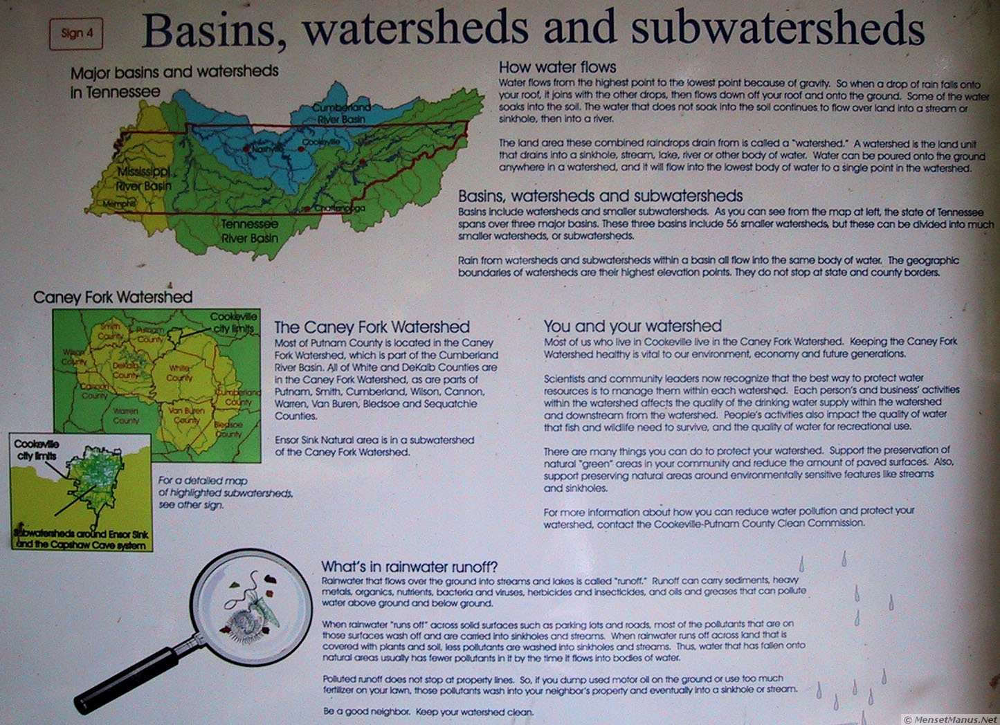 Text from Sign Number 4:
The land area these combined raindrops drain from is called a "watershed." A watershed is the land unit that drains into a sinkhole, stream, lake, river or other body of water. Water can be poured onto the ground anywhere in a watershed, and it will flow into the lowest body of water to a single point in the watershed.
Rain from watersheds and subwatersheds within a basin all flow
into the same body of water. The geographic boundaries of
watersheds are their highest elevation points. They do not stop at
state and county borders.
Ensor Sink Natural area is in a subwatershed of the Caney Fork Watershed.
For a detailed map of highlighted subwatersheds, see other sign.
Scientists and community leaders now recognize that the best way to protect water resources is to manage them withing each watershed. Each person's and business' activities within the watershed affects the quality of the drinking water supply within the watershed and downstream from the watershed. People's activities also impact the quality of water that fish and wildlife need to survive, and the quality of water for recreational use.
There are many things you can do to protect your watershed. Support the preservation of natural "green" areas in your community and reduce the amount of paved surfaces. Also, support preserving natural areas around environmentally sensitive features like streams and sinkholes.
For more information about how you can reduce water pollution
and protect your watershed, contact the Cookeville-Putnam County Clean
Commission.
When rainwater "runs off" across solid surfaces such as parking lots and roads, most of the pollutants that are on those surfaces wash off and are carried into sinkholes and streams. When rainwater runs off across land that is covered with plants and soild, less pollutants are washed into sinkholes and streams. Thus, water that has fallen onto natural areas usually has fewer pollutants in it by the time it flows into bodies of water.
Polluted runoff does not stop at property lines. So, if you dump used motor oil on the ground or use too much fertilizer on your lawn, those pollutants wash into your neighbor's property and eventually into a sinkhole or stream.
Be a good neighbor. Keep your watershed clean.
| Quote of the moment |
| Above the smoke and stir of this dim spot Which men call earth. |
| ~ John Milton, Comus. Line 5. ~ |
Common sense isn't.
Images stored locally for protection of your privacy (unless/until you search with Google). Stomp out web bugs (archive.org).
Copyright © 2000- hal9000[zat]mensetmanus.net
I last touched this page on Monday, 2022-11-07 at 16:17:00 UTC.