Common sense isn't.
Note: The visitor overlook was
previously (before September 11, 2001) open for self-guided, public
tours, but access to the road to ORNL is currently restricted by
security checkpoints. I recommend contacting the American Museum of Science and Energy in
Oak Ridge for the latest details on how to visit these areas.
Although the general area was previously open to public access,
it is clear that the visitor overlook has been neglected for at
least a couple years or more. I last personally visited it in 1995,
at which time the facility was in good shape, and the video
equipment was still operating. This is clearly no longer the case,
and has not been for quite some time.
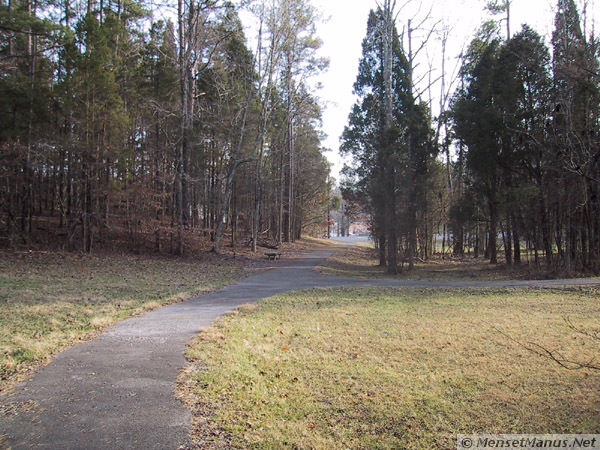
 The tour begins from the parking area with a short walk down an
asphalt paved walkway. The main lab facility is straight ahead,
across Bethel Valley Road.
The tour begins from the parking area with a short walk down an
asphalt paved walkway. The main lab facility is straight ahead,
across Bethel Valley Road.
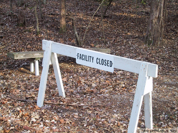
The trail to turns to the left along a dirt trail, up a slight hill to the overlook.
"Facility Closed" is apparently the official status of the
overlook, but the trail itself is in reasonably good shape (for a
dirt trail through the woods).
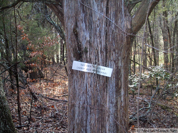 Along the way, one can still see
some remnants of an old interpretive nature trail, like this sign
on an "Eastern Red Cedar."
Along the way, one can still see
some remnants of an old interpretive nature trail, like this sign
on an "Eastern Red Cedar."
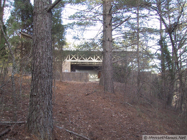 Soon the overlook building
comes into view at the top of the hill, up a slightly increasing
incline.
Soon the overlook building
comes into view at the top of the hill, up a slightly increasing
incline.
Just before reaching the overlook, you may notice a small plaque
mounted on a concrete block on the ground next to the trail.
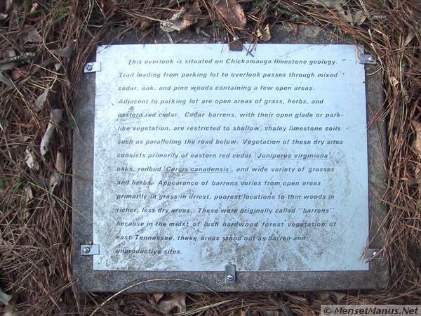 "This overlook is situated on
Chickamauga limestone geology. Trail leading from parking lot to
overlook passes through mixed cedar, oak, and pine woods containing
a few open areas. Adjacent to parking lot are open areas of grass,
herbs, and eastern red cedar. Cedar barrens, with their open glade
or park-like vegetation, are restricted to shallow, shaley
limestone soils such as paralleling the road below. Vegetation of
these dry sites consists primarily of eastern red cedar (Juniperus
virginiana), oaks, redbud (Cercis canadensis), and wide variety of
grasses and herbs. Appearance of barrens varies from open areas
primarily in grass in driest, poorest locations to thin woods in
richer, less dry areas. These were originally called "barrens"
because in the midst of lush hardwood forest vegetation of east
Tennessee, these areas stood out as barren and unproductive
sites."
"This overlook is situated on
Chickamauga limestone geology. Trail leading from parking lot to
overlook passes through mixed cedar, oak, and pine woods containing
a few open areas. Adjacent to parking lot are open areas of grass,
herbs, and eastern red cedar. Cedar barrens, with their open glade
or park-like vegetation, are restricted to shallow, shaley
limestone soils such as paralleling the road below. Vegetation of
these dry sites consists primarily of eastern red cedar (Juniperus
virginiana), oaks, redbud (Cercis canadensis), and wide variety of
grasses and herbs. Appearance of barrens varies from open areas
primarily in grass in driest, poorest locations to thin woods in
richer, less dry areas. These were originally called "barrens"
because in the midst of lush hardwood forest vegetation of east
Tennessee, these areas stood out as barren and unproductive
sites."
Go to: [ History ] [ Trail ] [ Overlook ]
Disclaimer Fine Print: This site is personal, and is independent of ORNL or any other organization. Use of the abbreviation "ORNL" and the name "Oak Ridge National Laboratory" is purely for descriptive purposes. No endorsement, no approval, and no involvement by ORNL is implied.
| Quote of the moment |
| Accept everything about yourself - I mean everything, You are you and that is the beginning and the end - no apologies, no regrets. |
| ~Clark Moustakas ~ |
Common sense isn't.
Images stored locally for protection of your privacy (unless/until you search with Google). Stomp out web bugs (archive.org).
Copyright © 2000- hal9000[zat]mensetmanus.net
I last touched this page on Saturday, 2007-11-17 at 04:58:53 UTC.