[Home] [Windpower Home Page] [Regenesys Dangers] [Directions] [Troubles Nearby] [Dirty] [FOIA] [Ground Zero] [Tour] [Friendly?] [Spinnin'] [Bottom Line - Performance] [Power Calculator] [Basis] [Storage] [Assembly] [Construction] [18 Operating] [Area History] [California Dreamin'] [Texas]
Common sense isn't.
Driving
Route 66 through
Oklahoma
 Been there, done that, or at least most of that,
anyway. Why? Maybe it's the appeal
of the seemingly free, open, side road, or maybe just nostalgia. In any
case,
here are
some photos from a 2003 trip through Oklahoma to Texas. There are
many photos like them, but
these photos are mine.
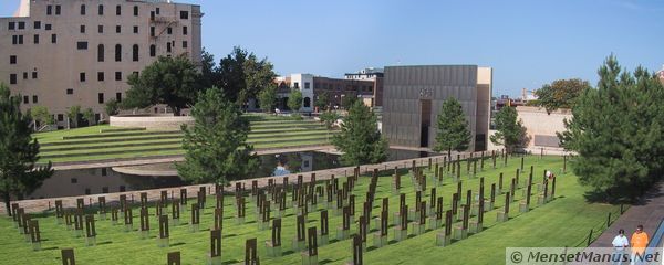
Oklahoma City bombing
Memorial site:
2 Photos stitched using
autopano, hugin, enblend, and Gimp.
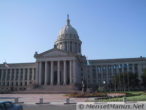
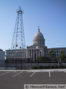
View from the steps of
the Oklahoma Capitol Building:
2 Photos stitched using
autopano, hugin, enblend, and Gimp.
Note: Following Text was
taken from monument and sign.
 Oklahoma
City Oil
Field
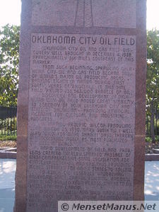
Oklahoma City Oil and
Gas Field discovery well brought in December 4, 1928, approximately six
miles southeast of this marker.
From such beginning, sprawling Oklahoma City Oil and Gas Field became
one of world's major oil producing areas, ranking eighth in nation
during first forty years of existence. In this time field yielded
733,543,000 barrels of oil.
Discovery and development of Oklahoma City Oil Field added great
stability to economy of Oklahoma - providing financial incentive for
cultural and industrial progress.
In tapping prolific Wilcox producing zone March 25, 1930, Mary Sudik
No. 1 well blew "wild" for more than 11 days, thereby distinguishing
itself as "most publicized oil well in world."
 Rapid
development of field, and problems created thereby, sparked
passage of first comprehensive state legislation for conservation of
oil and gas, thus providing model statutes for other states to follow.
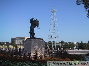
To reach oil reserves underlying Oklahoma State Capitol Building, one
well was slant drilled from across street to oil sands beneath capitol.
Discovery well and "Wild Mary Sudik" were both drilled by Indian
Territory Illuminating Oil Co., an affiliate of Cities Service Oil Co.,
and by Foster Petroleum Co.
 Oklahoma Industrial
Development and Park Commission
Oklahoma City Oil Field
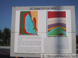
Pre-Pennsylvanian
Geologic Map / Structural Cross Section
The Oklahoma City Field is one of the giant fields of the world, having
produced more than 735 million barrels of oil and more than 2 trillion
cubic feet of gas from 26 producing zones through 1969. The ultimate
recovery from this field is estimated to be 770 million barrels.
Geologists first recognized a structure favorable for the accumulation
of oil near Oklahoma City in 1917, but it was more than 10 years later
that the Indian Territory Illuminating Oil Company (Later Cities
Service) drilled the discovery well of the Oklahoma City field. In
December 1928, the Itio No. 1 Oklahoma City "blew in" while drilling
cement at 6,402 feet. Initial gauge from the Arbuckle Dolomite was
6,565 barrels of oil per day.
 The reservoirs of
this field are in porous sedimentary rock layers that
were formed over eons of time by the accumulation of sediments in the
seas that once covered this part of Oklahoma. Sedimentary deposition on
the Pre-Cambrian granite "basement" began about 600 million years ago
and continued with a few interruptions for nearly 300 million years, at
which time a mountain range was formed by the upward arching and
faulting of the granite. The growth of the range deformed and faulted
the over-lying rocks, causing those on the west side of the fault to
move to a higher elevation than those on the east and elevating the
rock layers above sea level. The exposed rocks were then eroded to a
relatively flat surface. This erosion surface, called an unconformity,
is indicated on the cross section at the right by the wavy line. The
map at the left shows the rock distribution on this surface and is, in
effect, a geologic map of the area as it was 320 million years ago,
before it was again inundated by the sea and covered by several
thousand feet of Pennsylvanian and Permian sediments. Later upward
movement of the buried mountain range and movement along the fault
arched and disrupted these younger rock layers, although to a much
lesser degree than the older rocks below the unconformity. All these
geologic events produced conditions most favorable for the entrapment
of oil and gas.
The pumping well to the left of this sign was directionally drilled so
that it is producing oil from directly beneath the capitol building.
Supported by contributions
from Oklahoma geologists | Oklahoma
Geological Survey
Note: Previous Text was
taken from monument and sign.
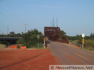
Unused, old, paved Route 66
side road, somewhere in the vast expanse of Oklahoma. Old Route 66 is
never far from the newer Interstate highway, the railroad, or both.


| Quote of the moment |
>consult guide about intelligence
The Guide checks through its Sub-Etha-Net database and eventually comes up with the following entry:
Thirty million generations of philosophers have debated the definition of intelligence. The most popular definition appears in the Sirius Cybernetics Corporation android manuals: "Intelligence is the ability to reconcile totally contradictory situations without going completely bonkers -- for example, having a stomach ache and not having a stomach ache at the same time, holding a hole without the doughnut, having good luck and bad luck simultaneously, or seeing a real estate agent waive his fee." |
| ~ Hitchhikers Guide to the Galaxy
~ |
Thanks to Highland Media
[Home] [Windpower Home Page] [Regenesys Dangers] [Directions] [Troubles Nearby] [Dirty] [FOIA] [Ground Zero] [Tour] [Friendly?] [Spinnin'] [Bottom Line - Performance] [Power Calculator] [Basis] [Storage] [Assembly] [Construction] [18 Operating] [Area History] [California Dreamin'] [Texas]
Common sense isn't.
Images stored locally for protection of your privacy (unless/until you search
with Google).
Disclaimer Fine Print: This site is personal, and is independent
of TVA or any other organization. Use of the abbreviation "TVA" is
purely for descriptive purposes (for example, to distinguish from
wind power plants on Buffalo Ridge in Minnesota). No
endorsement, no approval, and no involvement by TVA
is implied.
Copyright © 2000- hal9000[zat]mensetmanus.net
I last touched this page on
Sunday, 2022-11-06 at 15:44:12 UTC.
W3C Markup Validator Check
Site optimized for any modern browser,
any size screen, any resolution, and no plug-ins; prepared and served with
Free BSD, and
Debian GNU / Linux
 Been there, done that, or at least most of that,
anyway. Why? Maybe it's the appeal
of the seemingly free, open, side road, or maybe just nostalgia. In any
case,
here are
some photos from a 2003 trip through Oklahoma to Texas. There are
many photos like them, but
these photos are mine.
 Rapid
development of field, and problems created thereby, sparked
passage of first comprehensive state legislation for conservation of
oil and gas, thus providing model statutes for other states to follow.
 The reservoirs of
this field are in porous sedimentary rock layers that
were formed over eons of time by the accumulation of sediments in the
seas that once covered this part of Oklahoma. Sedimentary deposition on
the Pre-Cambrian granite "basement" began about 600 million years ago
and continued with a few interruptions for nearly 300 million years, at
which time a mountain range was formed by the upward arching and
faulting of the granite. The growth of the range deformed and faulted
the over-lying rocks, causing those on the west side of the fault to
move to a higher elevation than those on the east and elevating the
rock layers above sea level. The exposed rocks were then eroded to a
relatively flat surface. This erosion surface, called an unconformity,
is indicated on the cross section at the right by the wavy line. The
map at the left shows the rock distribution on this surface and is, in
effect, a geologic map of the area as it was 320 million years ago,
before it was again inundated by the sea and covered by several
thousand feet of Pennsylvanian and Permian sediments. Later upward
movement of the buried mountain range and movement along the fault
arched and disrupted these younger rock layers, although to a much
lesser degree than the older rocks below the unconformity. All these
geologic events produced conditions most favorable for the entrapment
of oil and gas.